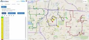
For those involved in web mapping in general, or route planning, a common question that’s frequently asked is: What is geocoding?
Geocoding is the process of taking an address and converting it to coordinates that can be displayed on a web map or used for routing. In RouteSavvy, these coordinates are a decimal latitude (e.g. 34.100330) and longitude (e.g. -81.220290) values.
Geocoding is critical because if the address or geocoding process are not accurate, then it can affect routing. For example, if the address has an issue and does not geocode, then how could you route to that location? The worst-case scenario is that the address or geocode is bad and the driver cannot find the stop and wastes time and fuel driving around trying to find the location.
In RouteSavvy, there are a couple options to help address geocoding problems.
The RouteSavvy Data Wizard (accessed from the Map tab) is used to do bulk import addresses. Once imported, each address is geocoded and a Match Type is displayed in the Geocoding Results. This match type indicates the quality of the geocoding results.
The Address Match Type is the best result. This means that the geocoder found the address. Address2 is the next best, which means the geocoder got an address match BUT changed some part of the input address.
Here are all the possible match types.
| Name | Description |
| Address | A street address match (best for accurate routing) |
| Address2 | A street address match (2nd best, but some part of the address was corrected by the geocoder) |
| AdminDivision1 | First administrative level within the country/region level, such as a state or a province. |
| AdminDivision2 | Second administrative level within the country/region level, such as a county. |
| Country/Region | Country or region |
| Neighborhood | A section of a populated place that is typically well-known, but often with indistinct boundaries. |
| PopulatedPlace | A concentrated area of human settlement, such as a city, town, or village. |
| Postcode1 | The smallest post code category, such as a zip code. |
| Blank/no match type | The geocoder did not find any result, often because city, state, AND zip code is missing. |
Any match type except Address or Address2 can happen because there was a bad address or the address was incomplete. You can try and fix the address by editing the import spreadsheet or mappings (which data fields are being used) in Data Wizard. Or once the import is complete, you can see any locations with issues with a red warning and either fix the address in the Edit Location dialog box or Accept Geocoding Issues and route to that location anyway.
Hopefully, this quick primer helped answer the question: what is geocoding. Accurate addresses are the key to accurate geocoding. This should help you understand why it’s so important that the addresses entered into RouteSavvy are complete and accurate. But if there are problems with any of the addresses, RouteSavvy is smart enough to find and identify them for you.
Want to learn more about RouteSavvy route planning software for businesses & non-profits with small to mid-sized fleets? Try our Free, 14-day Trial!


