RouteSavvy User Guide – 3.2 – Add Stops to A Route
To create a route, at least 2 locations (4 for optimizations) need to be added to a route. Stops are added to a route by:
- Using the Quick Route tool to create multiple routes at once
- Adding individual locations as a stop
- Adding a folder as stops
- Drawing a shape around locations and adding them as stops
Location(s) that are added to a route will display as stops with rectangular icons. Each icon is numbered to indicate the current order of the stop on the route. The first stop (start) of the list is green, the last stop (End) is red, and all other stops (in-between) are yellow.
If you can see the green, yellow, and red stop numbers on the map, this indicates the active route. If the route is active, then it is selected/active on the Route Planner tab, and it is also active on the Directions tab if you want to send directions for that route.
RouteSavvy will never reorder the start or end stop, it only optimizes the yellow, in-between stops.
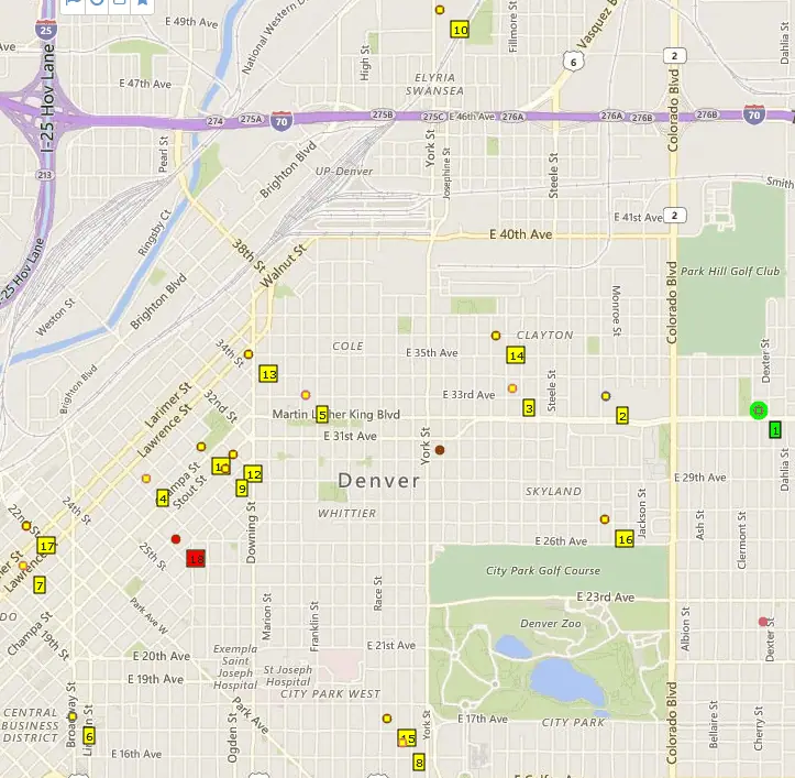

There are multiple ways you can add stops to a route.
1. Add Individual Locations
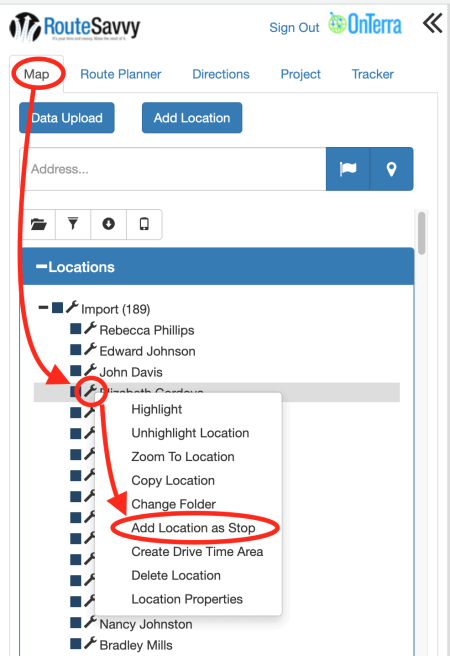
Right-click a location or left-click the wrench in the list of locations on the Map tab, and select “Add Location as Stop”.
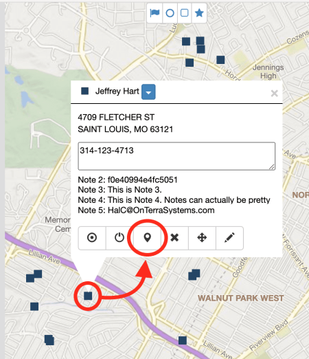
You can also left-click any location on the map and click the “Add as Stop” icon. It does not matter what tab is selected in RouteSavvy, since this action takes place on the map pane on the right-hand side. The stop will always be added to the currently-active route on the Route Planner tab.
2. Add All Locations in a Folder
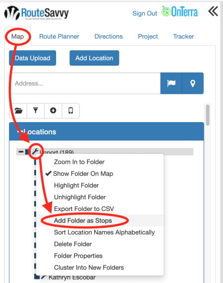
Right-click a folder name or left-click the wrench next to the folder name on the Map tab, and select “Add Folder as Stops”. This adds all the locations in the folder to as stops on the Route Planner tab.
3. Draw a Shape Around Locations
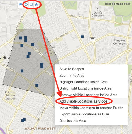
Select a shape tool (circle, rectangle, or polygon) from the buttons at the top of the Map and draw a shape around a set of locations. Right-click inside the shape to open the context menu containing the option “Add Visible Locations as Stops.” This option will add all Locations inside the Shape as stops. Context menu “Add Visible Locations as Stops” is available for all shapes, whether they are temporary (like the gray shape in the image below) or saved.
More on working with Shapes can be found here.
Please note: This option only adds the visible locations inside the shape. If you make some locations invisible by “unshowing” them from the map, then they will not be added to the route when the “Add visible Locations as Stops” option is selected.
Add Stops Warning
If any of the locations being added as a stop have geocoding issues, RouteSavvy will display a warning. You can choose “Accept Locations with Issues” or “Don’t Accept Locations with Issues”. If you don’t accept the location(s), any location with a geocoding issue will not be added to the route, but the stops without geocoding issues will be added.

If you have questions contact RouteSavvy Support.
